Primary Route
Bradley Pond Trailhead via Santanoni Express, Couchsachraga, and Panther
Standard Route

The Santanoni Range links Santanoni, Couchsachraga, and Panther in one remote, muddy, navigation-heavy High Peaks loop from Bradley Pond, with the Express Trail, Times Square, Couchsachraga Bog, and Panther’s summit views defining the day.
Have photos of this hike?
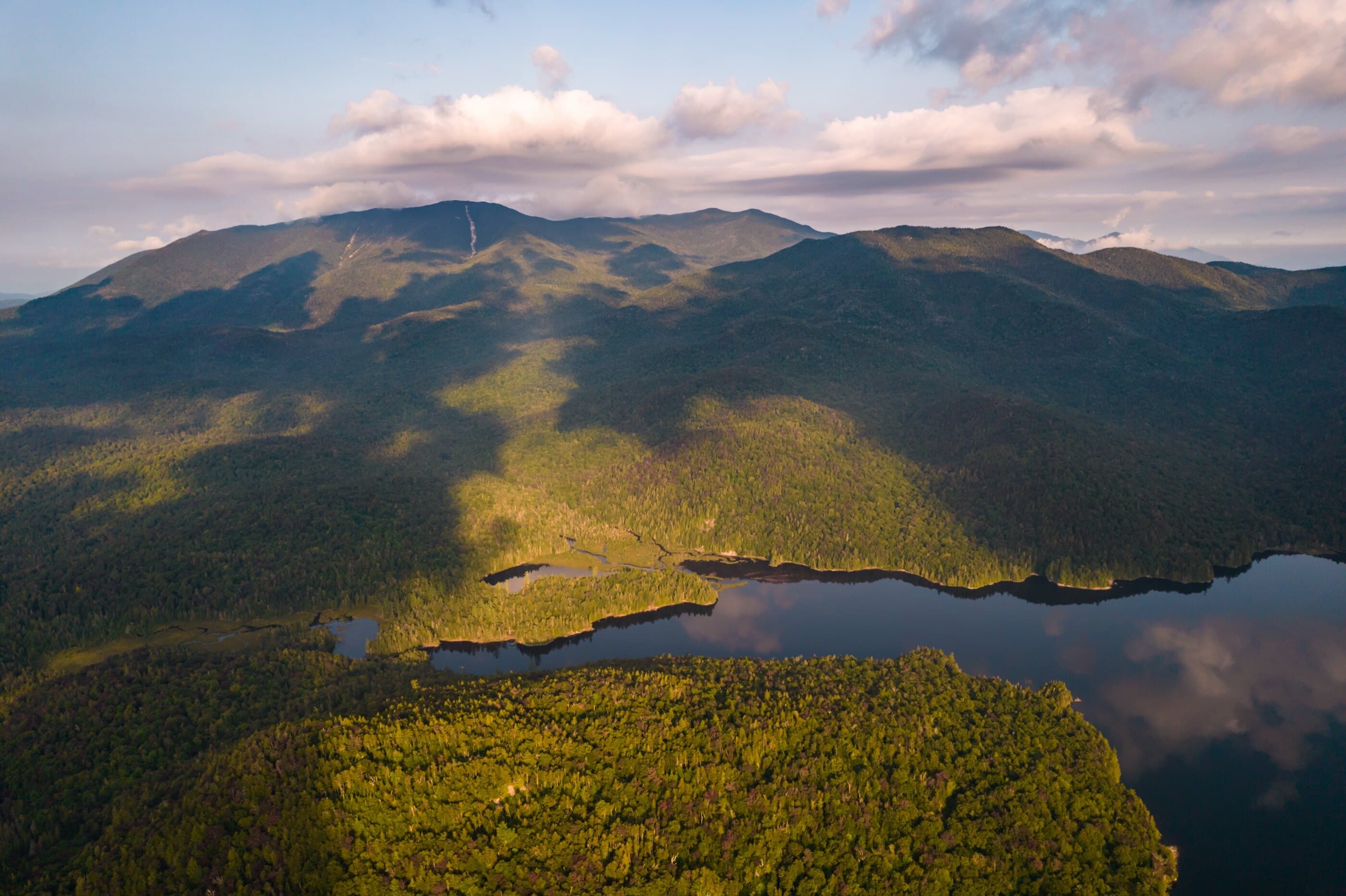
Route map
Planning use
Use the route line and GPX as planning aids. Carry a physical map and verify current official conditions before relying on any route.
Open the Interactive 46 High Peaks MapRoute History
The Santanoni Range carries one of the most distinctive naming histories in the High Peaks. Santanoni is often linked to Saint Anthony, the patron saint of the Saint Regis and Abenaki people, though some traditions connect the name to Abenaki forms such as Sandanona or Si-non-bo-wanne; the name appeared on maps by 1838. Panther Peak was identified on the 1901 USGS map and follows the Adirondack habit of naming landscape features after animals, with Daniel Lynch credited with its first recorded ascent in 1904. Couchsachraga, often pronounced Kook-suh-krah-guh, was once believed to rise above 4,000 feet before a 1954 USGS survey corrected it to 3,820 feet. Its name is tied to the Cold River country between the Santanoni and Seward ranges and is commonly translated as “the great dismal wilderness” or “beaver hunting grounds.”
Primary Route
Standard Route
Route Overview
The Santanoni Range route climbs Santanoni first by the Express Trail, descends to Times Square, makes the long muddy out-and-back to Couchsachraga, climbs Panther, then descends past Bradley Pond to Santanoni Road.
Selected Route Access
Begin at Bradley Pond Trailhead, use Santanoni Road to reach Bradley Pond Trail, then climb the Express Trail to Santanoni before crossing the unmarked range route toward Times Square, Couchsachraga, and Panther.
Selected Route Caution
This is a muddy, remote, navigation-heavy High Peaks loop. Carry a map, manage water during planning the lower approach, and leave enough daylight for the full loop. Times Square and the Couchsachraga spur require attention even for experienced hikers.
Selected Route Guidance
Full guide collapsed for quick scanning. 7 sections available.