

Ampersand Mountain
High Peaks Region • High Peaks Region
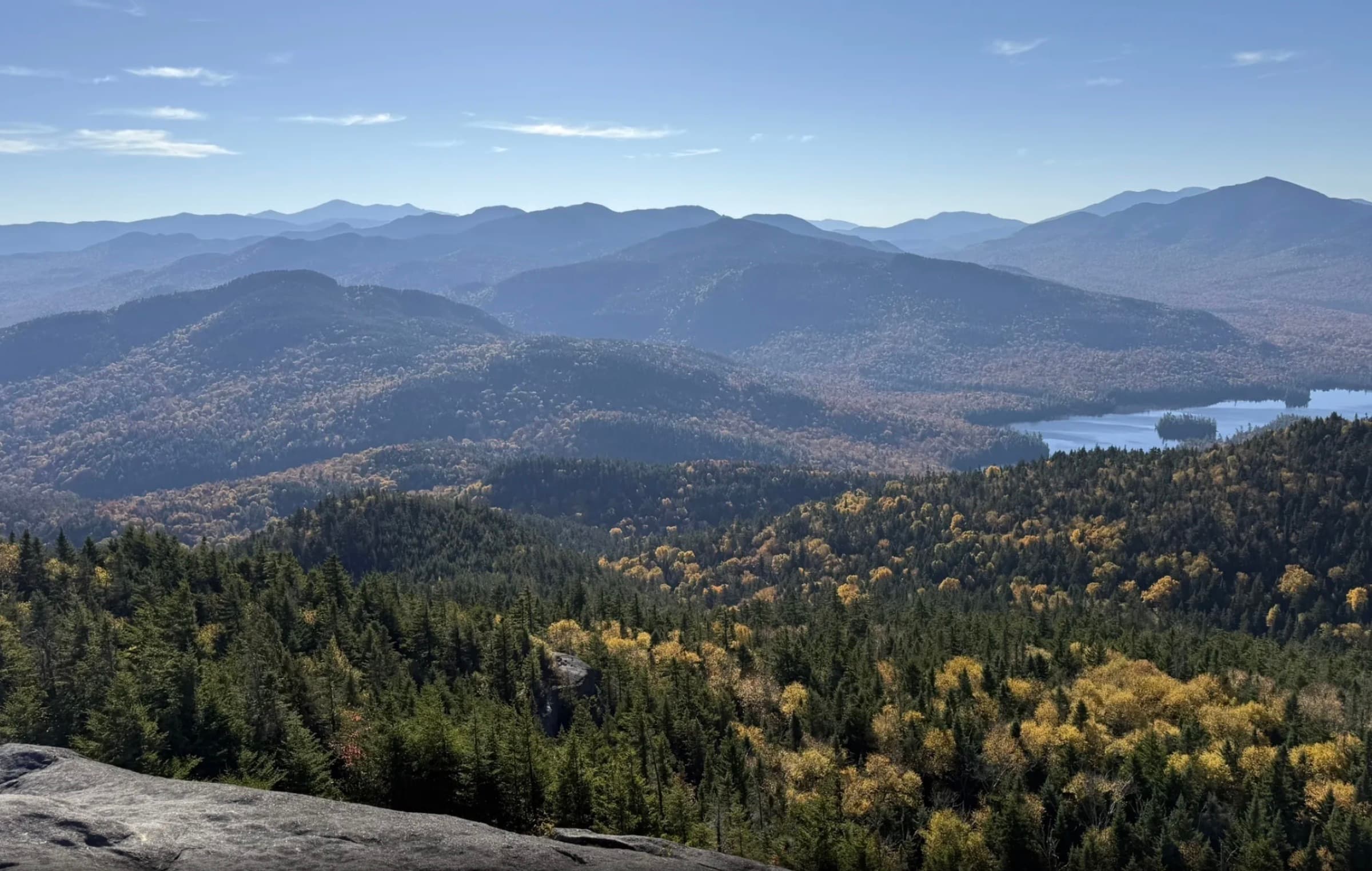
Ampersand Mountain is a steep Saranac Lake 6er with a forested approach, rocky upper climb, and broad open summit views.
Photo Gallery
Have photos of this hike?
Destination map
Ampersand Mountain
Map note
This map marks the hiking objective itself.
Route files
Route lines and GPX downloads are available only for selected launch routes. Most destination maps will remain objective-only until a later version.
Route Guidance
Trail Overview
Ampersand Mountain rises above the Saranac Lake area with a 5.4-mile round-trip route from Route 3. The hike begins moderately through mature forest and wet sections before steepening past the old observer cabin site, stone steps, rockier footing, and large summit boulders. Hikers go for the exposed summit and wide 360-degree views across the High Peaks Wilderness and surrounding lakes. The difficulty feels concentrated in the upper half, especially in wet weather or winter.
Access
Signed roadside lot on the north side of NY-3; fills early on busy days.