
Boreas Ponds
High Peaks Region • High Peaks Region
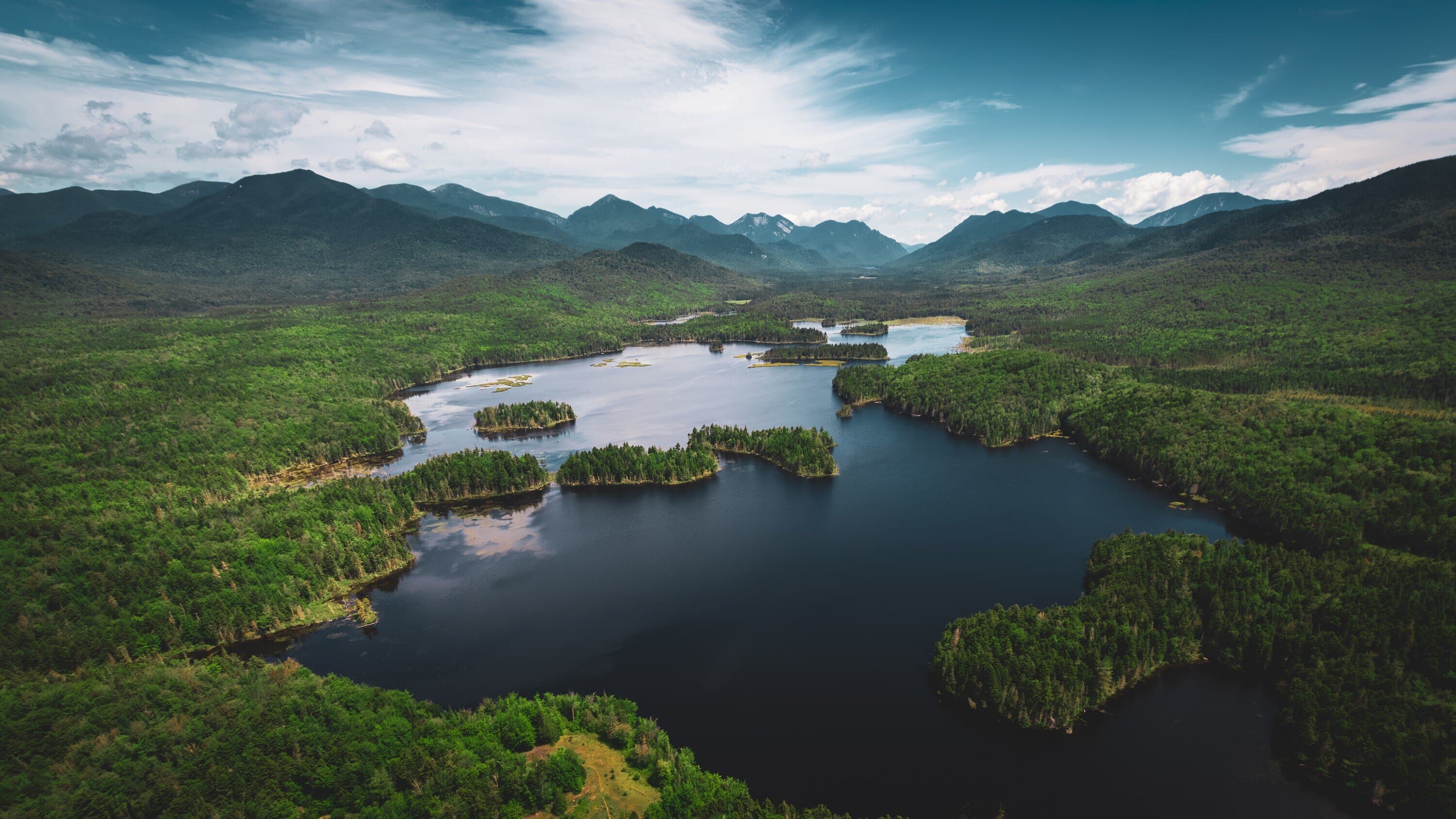
Boreas Ponds is a High Peaks-edge water destination where quiet road walking leads to broad water, wild shoreline, and mountain views.
Photo Gallery
Have photos of this hike?
Destination map
Boreas Ponds
Map note
This map marks the hiking objective itself.
Route files
Route lines and GPX downloads are available only for selected launch routes. Most destination maps will remain objective-only until a later version.
Route Guidance
Trail Overview
Boreas Ponds sits on the southern edge of the High Peaks in the Boreas Ponds Tract. The hike is best understood as a quiet road-walk waterbody outing rather than a steep trail climb. Hikers approach through the Gulf Brook Road / Four Corners access system toward the ponds, dam area, and broad mountain backdrop. Boreas Ponds is a 320-acre waterbody and one of the largest in the park completely surrounded by Forest Preserve. Plan around seasonal road access, designated parking, and the fact that this is a scenic water-and-wild-space objective more than a rugged summit hike.
Access
Use designated parking only at the Four Corners Parking Area within the Gulf Brook Road / Boreas Road access system. Roadside parking is prohibited.
Seasonal Notes
Road access can change with season, weather, and management conditions. Check DEC before planning around Gulf Brook Road access.
Cautions
Gulf Brook Road access is seasonal and road-condition dependent. Use designated parking only. DEC prohibits roadside parking, and bikes are prohibited beyond the gate at the Boreas Ponds Parking Area near the dam.