Route caution
This is a long unmarked High Peaks bushwhack. Carry real navigation tools, track your exit line, and turn around early if weather, pace, daylight, water, or route-finding starts to deteriorate.

Lost 46er Guide
The Lost 46er
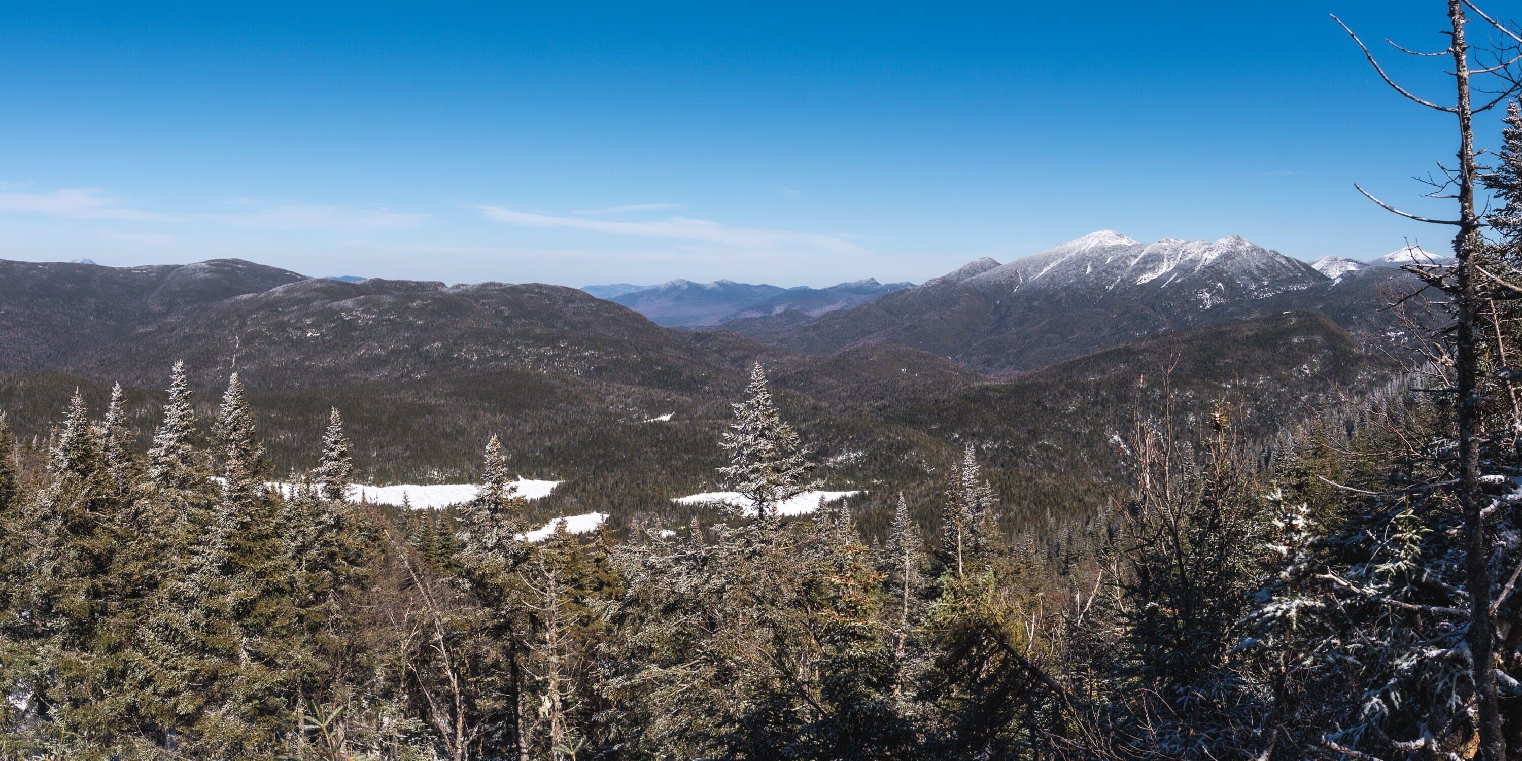
MacNaughton Mountain is the Adirondacks’ Lost 46er, a long and serious High Peaks bushwhack reached from the Adirondack Loj and Wallface Ponds corridor.
Have photos of this hike?
Route map
Planning use
Use the route line and GPX as planning aids. Carry a physical map and verify current official conditions before relying on any route.
Why MacNaughton is the Lost 46er
MacNaughton Mountain is named for James MacNaughton, the grandson of the owner of McIntyre Iron Works. It was left off the original roster of Adirondack 4,000-footers, but 1950s USGS surveys later confirmed its elevation and gave the mountain a lasting place in High Peaks history. Its ascent is known for cripple-bush, blowdown, thick forest, and limited views, which has only added to its secluded reputation among 46ers and experienced hikers. More recent survey work used a surveyor-grade GPS unit on the summit for more than an hour, communicating with two base stations, and measured the summit at 4,005.3 feet. A licensed surveyor verified that the tenth-of-a-foot precision was justified. That measurement confirms MacNaughton rises above 4,000 feet and supports the stronger accuracy of the 1953 USGS topographic contouring compared with the later 1979 metric series, which misrepresented the 4,000-foot contour on MacNaughton.
Route caution
This is a long unmarked High Peaks bushwhack. Carry real navigation tools, track your exit line, and turn around early if weather, pace, daylight, water, or route-finding starts to deteriorate.
Route Overview
Long out-and-back from Adirondack Loj / HPIC through the Indian Pass and Wallface Ponds corridor, followed by an unmarked MacNaughton bushwhack to the summit ridge. The route is defined by approach distance, terrain reading, drainage navigation, and careful descent planning.
Detailed route guide
Begin near the entrance area at Adirondack Loj, using the trail signed for Mount Jo and Indian Pass. The route starts on a small gravel path and quickly moves toward Heart Lake. Continue past the ADK property buildings and around the lake toward the official register. Sign in before continuing on the Indian Pass Trail.
From the register, follow the Indian Pass Trail for the long approach toward Scott’s Clearing. Rocky Falls comes along the way, then Scott’s Clearing arrives about 4.5 miles from the Loj. The lean-to area is the first major reset point and a practical place to eat, adjust layers, refill if possible, and decide whether the group still has the time and energy to continue.
At Scott’s Clearing, turn right near the lean-to and cross a short river section. About 0.3 mile later, reach another signed turn and head toward Indian Pass Brook. The brook crossing area has degraded stonework, small spur paths, and enough visual noise that it deserves attention. The better crossing is generally downstream to the right before continuing toward Wallface Ponds.
The trail toward Wallface Ponds is rough, eroded, and often muddy. This part can already feel slow before the bushwhack begins. Wallface Ponds mark the end of the normal marked-trail approach and the last clear transition point before committing to the unmarked MacNaughton line.
Move around the pond shore toward the outlet between the two ponds, then reenter the woods. This is where the hike changes completely. From here, the route becomes a true bushwhack. Confirm your map position, compass bearing, return line, weather, daylight, and group condition before pushing deeper into the forest.
Work generally southwest through thick forest toward the drainage coming off MacNaughton. You may find faint traces of old foot traffic, but none should be trusted blindly. The drainage is one of the most useful terrain features on the route. Stay close enough to use it for orientation, then cross it when the line toward the ridge calls for a more direct southwest push.
As you near the top, the route may begin to feel more like an unofficial path. Look carefully for the spur leading to the summit sign. There is another high point roughly along the summit ridge that can look similar, so stay attentive and confirm where you are before turning around.
The return deserves the same focus as the climb. Leave the summit heading north, regain the drainage system, and work back toward the ponds and the marked trail. Try to retrace your line as closely as conditions allow, but the main goal is to avoid drifting away from the Wallface Ponds corridor before the long walk back through Scott’s Clearing and the Indian Pass Trail.
Before committing past Wallface Ponds