

Phelps Mountain
High Peaks Region • High Peaks Region
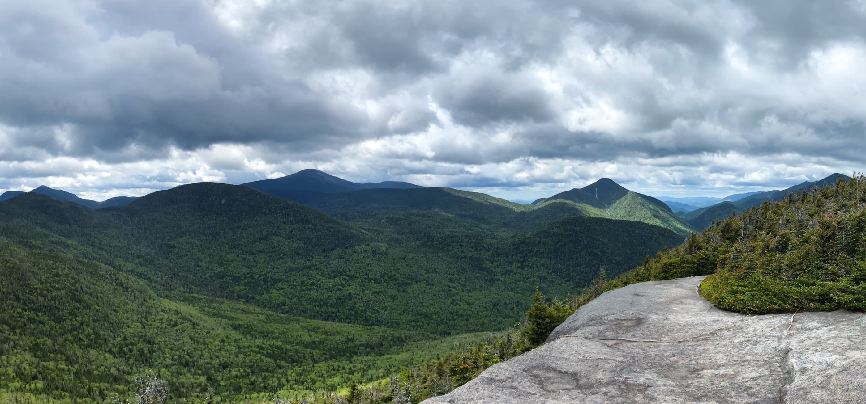
Phelps Mountain is a moderate High Peak from Adirondack Loj with classic Marcy Dam approach mileage and excellent summit ledge views.
Photo Gallery
Have photos of this hike?
Destination map
Phelps Mountain
Map note
This map marks the hiking objective itself.
Route files
Route lines and GPX downloads are available only for selected launch routes. Most destination maps will remain objective-only until a later version.
Doing the 46?
See the Phelps & Tabletop guide.
Open the Phelps and Tabletop guide to understand how both peaks use the Marcy Dam corridor before splitting into separate climbs.
Route Guidance
Trail Overview
Phelps Mountain is a classic Adirondack Loj High Peak, reached by the Marcy Dam and Van Hoevenberg corridor before a steep side climb to the summit. It is often paired with Tabletop, but Phelps alone still has real elevation gain and rocky footing.
Access
Adirondack Loj / HPIC is a paid, high-use High Peaks gateway; the lot often fills early on busy days.
Cautions
The Phelps side trail is steep and rocky, and the approach shares busy High Peaks corridor terrain. Wet rock, ice, and late-day fatigue can make the descent slower than expected.