

Rainbow Falls
High Peaks Region • High Peaks Region
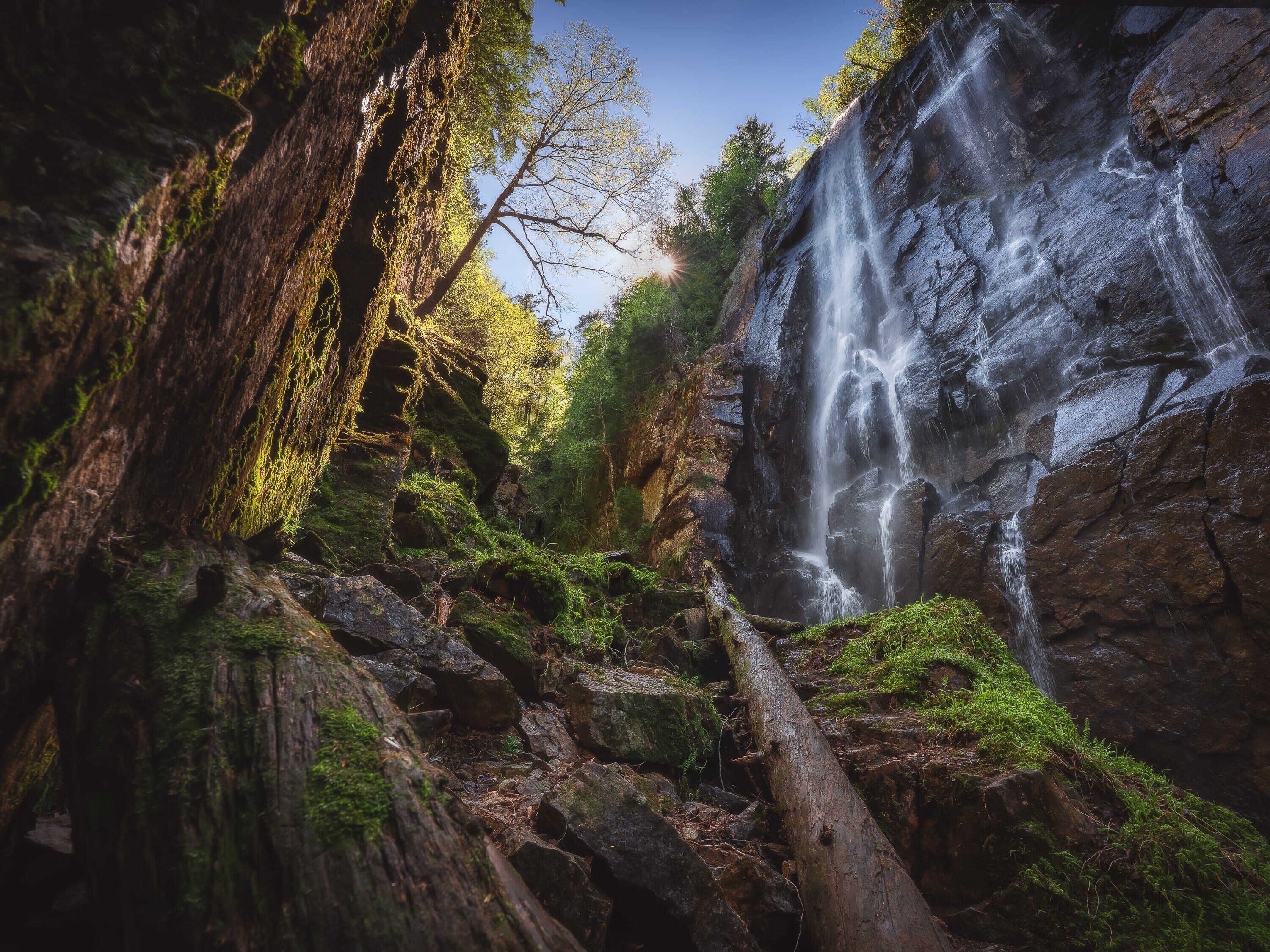
Rainbow Falls is a classic 150-foot AMR waterfall reached by a full-day Lake Road approach to Lower Ausable Lake, with bridges, junctions, slippery footing, and a dramatic canyon-like finish.
Photo Gallery
Have photos of this hike?
Destination map
Rainbow Falls
Map note
This map marks the hiking objective itself.
Route files
Route lines and GPX downloads are available only for selected launch routes. Most destination maps will remain objective-only until a later version.
Route Guidance
Trail Overview
Rainbow Falls is one of the Adirondack High Peaks region’s signature waterfall destinations. The hike is roughly 8.5 miles round trip with about 1,100 feet of elevation gain, following the Adirondack Mountain Reserve approach toward Lower Ausable Lake before turning toward the falls. The final section is rocky, wet, and slippery in places as the route follows the stream into a steep-sided gorge below the 150-foot waterfall. AMR reservation rules apply seasonally, and dogs are not allowed on AMR lands.