

Mount Colden
High Peaks Region • High Peaks Region
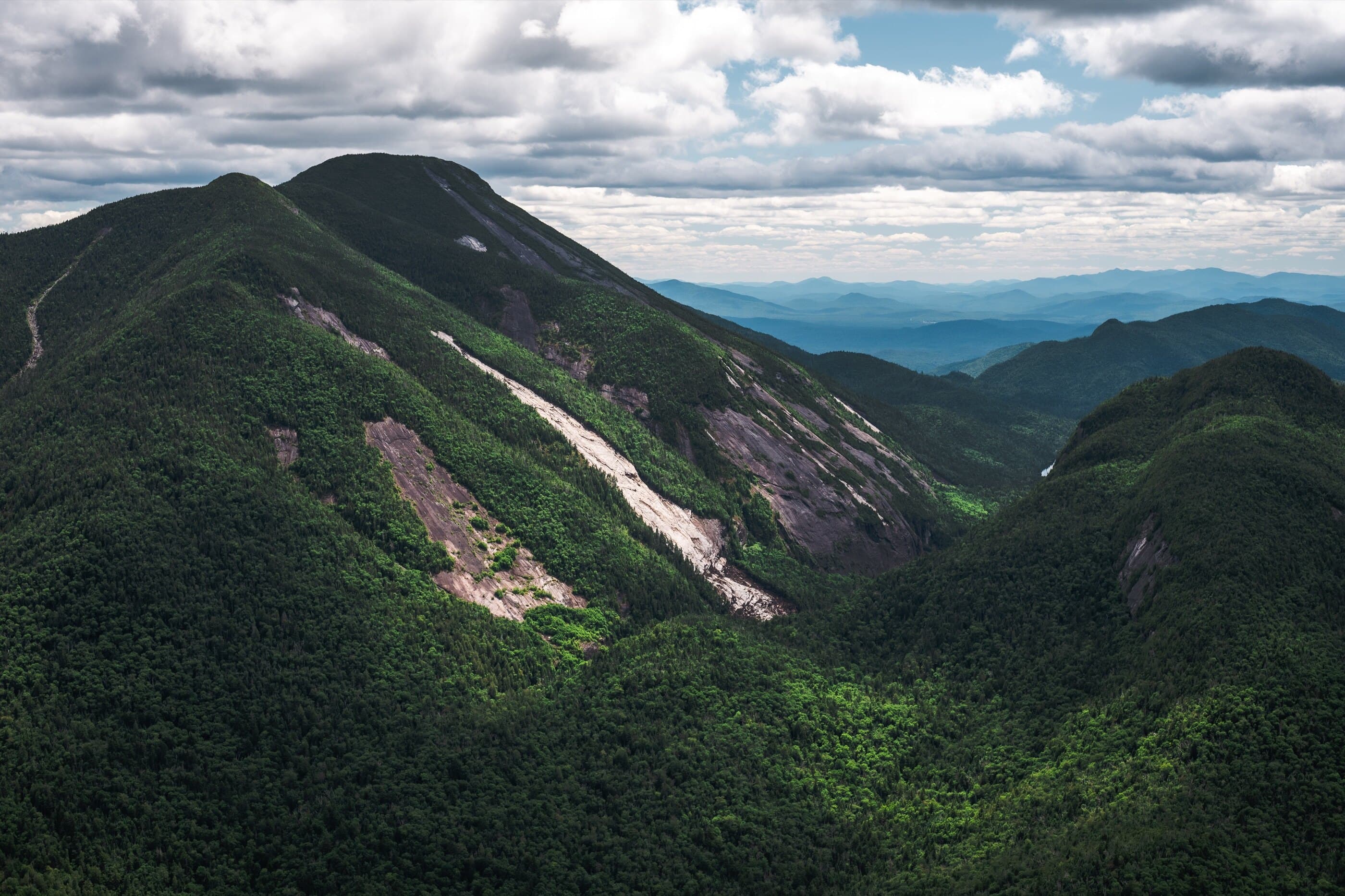
Mount Colden sits between Marcy and Algonquin and is known for dramatic slides, open summit ledges, and one of the most scenic standalone High Peaks climbs.
Photo Gallery
Have photos of this hike?
Destination map
Mount Colden
Map note
This map marks the hiking objective itself.
Route files
Route lines and GPX downloads are available only for selected launch routes. Most destination maps will remain objective-only until a later version.
Doing the 46?
See the Mount Colden guide.
Open the Mount Colden guide to compare the Lake Arnold out-and-back, the Avalanche Pass loop, and the Upper Works south-side approach.
Route Guidance
Trail Overview
Mount Colden sits between Marcy and Algonquin and stands out for its dramatic slides, open summit ledges, and balanced-rock views. The shortest standard hike climbs from Adirondack Loj by Lake Arnold and returns the same way.
Access
Start at Adirondack Loj / HPIC. Parking is paid and fills early on busy High Peaks days.
Cautions
Mount Colden has rough footing, mud near Lake Arnold, ladders and stairways near the ridge, exposed summit terrain, and alpine vegetation that must be protected. Wet slabs, ice, and low visibility can make the summit ridge and descent slow.