
Mount Marshall
High Peaks Region • High Peaks Region
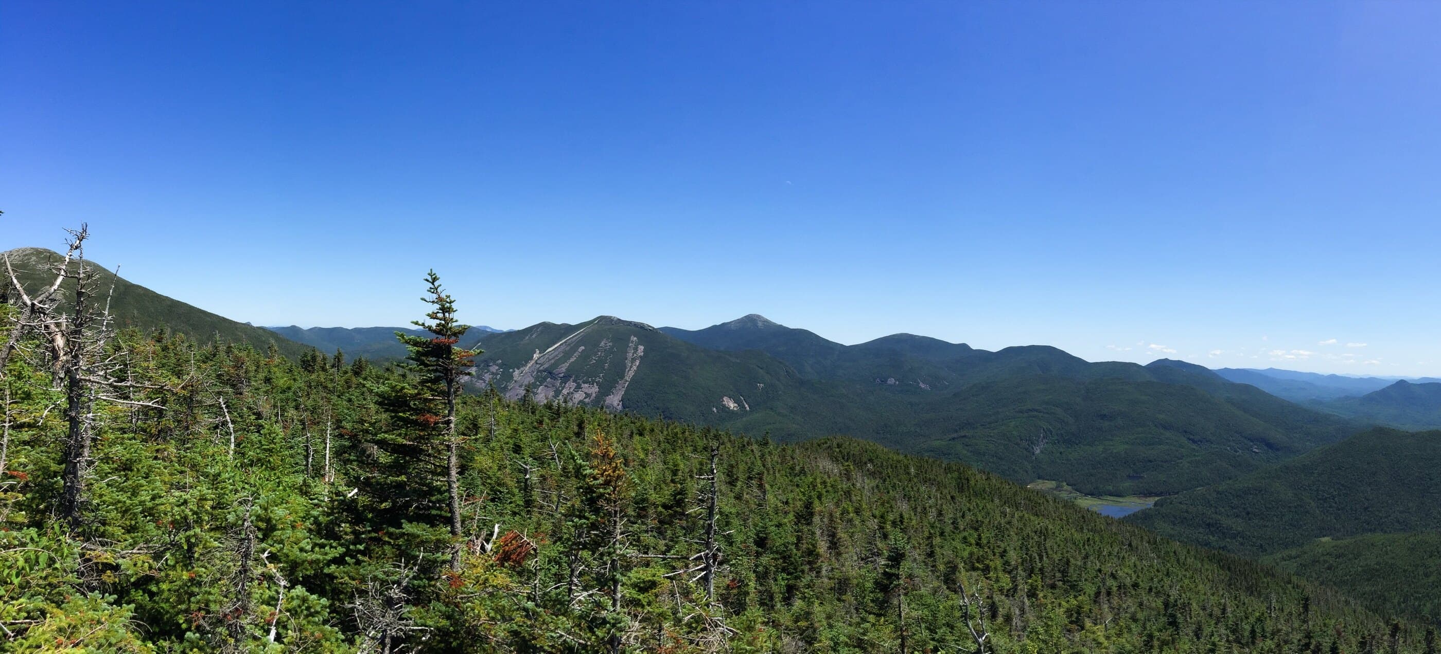
Mount Marshall is a remote MacIntyre Range High Peak with wild terrain, herd-path navigation, and views from ledges near the summit.
Photo Gallery
Have photos of this hike?
Destination map
Mount Marshall
Map note
This map marks the hiking objective itself.
Route files
Route lines and GPX downloads are available only for selected launch routes. Most destination maps will remain objective-only until a later version.
Doing the 46?
See the Mount Marshall guide.
Open the Mount Marshall guide to compare Upper Works, Adirondack Loj, and Indian Pass approaches with Herbert Brook herd-path context.
Route Guidance
Trail Overview
Mount Marshall is a remote, wooded High Peak usually climbed by an unmarked herd path after a long approach from Upper Works or Adirondack Loj. The summit itself is quiet, but the real difficulty is the approach distance, wet footing, and route-finding.
Access
Adirondack Loj / HPIC is a paid, high-use High Peaks gateway; the lot often fills early on busy days.
Cautions
Marshall requires unmarked herd-path travel and a long approach. If using Avalanche Pass or Cold Brook variations, verify current route status separately; Cold Brook is marked but unmaintained context, not a default recommendation.